Southwest of Moab, Utah and Arches National Park, and east of the north entrance to Canyonlands National Park is a state park named Dead Horse Point. The park's namesake point is a section of a high plateau that overlooks lower lands on three sides. The park is reached by following State Route 313 southward from U.S. Route 191, northwest of Moab. Route 313 leads directly to Dead Horse Point. Just after milepost 8, the route turns left, whereas continuing straight leads to Canyonlands.
The park has a visitor's center about a mile before the end of the road. From near the center, I took this shot of a canyon that makes a notch into the east side of the plateau.

Looking further out toward the southeast, I could see this bend in the Colorado River.

Also seen to the east was this solar evaporation pond.

I continued southward to the end of Route 313, where the park has viewing areas along the edge of the plateau. This is another view of the bend in the Colorado toward the southeast.

Here's another bend in the Colorado, looking southwest.

Also toward the southwest is yet another riverbend. Note the flat area above the river's canyon.

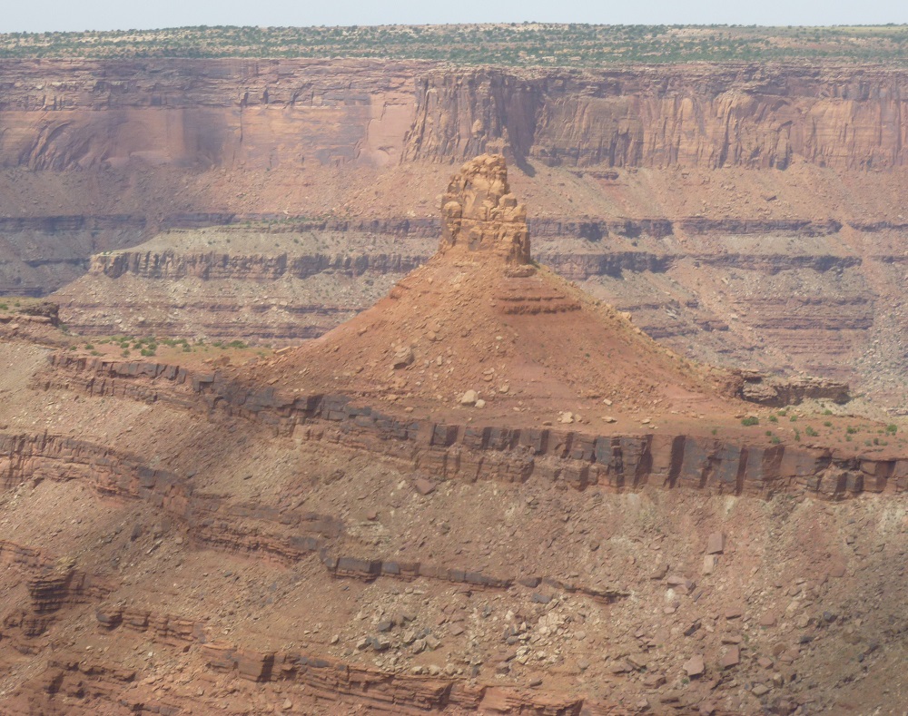
This spire, seen looking northwest, sits on top of a ridge near the river.
Across the Colorado to the west is this lonely dirt road.

Here's a more panoramic view that includes the riverbend seen above. In the upper right is another dirt road.

After leaving Dead Horse Point State Park, I stopped along Route 313 to view these two mesas.

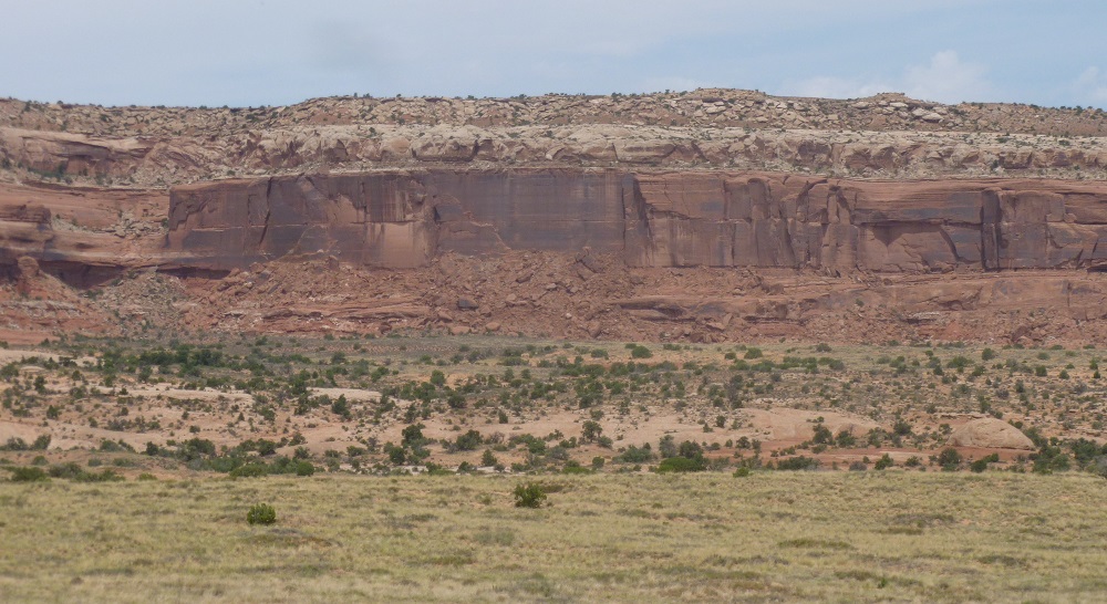
Nearby was a long ridge with some cliffs. This is just one section of it.
No comments:
Post a Comment